The W Trek is the most famous multi-day hike in Torres del Paine, a route that draws hikers from all over the world.
You’re not just walking through a national park. You’re following a path carved by wind, glaciers, and time. Every day brings something raw and unforgettable: jagged peaks, crackling ice, thundering waterfalls, and valleys that make you feel impossibly small.
The W Trek traces a “W” across three dramatic valleys: Grey, French, and Ascencio. You’ll hike 70 to 80 kilometers over 4 to 5 days, sleeping in campsites or refugios along the way. No need to carry a tent or stove, unless you want to.
You can start from either end. Whichever way you go, you’ll hit some of Patagonia’s greatest hits.
The trail is open year-round, but if you plan to hike during the winter season (typically April through October), you’ll need to go with a certified guide.
Table of contents
The W Trek overview
Total distance: 50 miles/80 kilometers
Difficulty: Moderately difficult
Total elevation gain: 8 956 feet/2 730 meters
? Open year-round, certified guide required for the winter season (usually from April to October).
Torres del Paine W Trek map
How to walk the W Trek
One of the first decisions you’ll need to make is whether to hike the W Trek from west to east or east to west. There’s no right answer; both directions take you through all the major highlights. It really comes down to how you want to pace your experience.
W Trek West to East
Going west to east is the most popular option. It starts with a scenic ferry ride and builds gradually to the dramatic final climb to Base Torres. A pretty unforgettable way to finish. If you like ending on a high note, this is your route.
Points to consider
Gradual difficulty: Starting from the west side of the W Trek means the trail eases you in. The first day is relatively gentle, which gives you a chance to find your rhythm before tackling the steeper sections later on.
The best for last: If you consider the Base Torres to be the park's highlight, save this experience for your final day.
Transportation: You’ll get the most complicated part of the logistics — the catamaran from Pudeto to Paine Grande — out of the way on day one. Once you’re across the lake, it’s just you and the trail.
W Trek West to East suggested itinerary
From Grey - 5 days/4 nights
This itinerary should give you an idea of where to make your reservations and the distance on each day, but you can always alter it to suit your needs.
Day 1: Grey | ➡ Walking distance: 11 kilometers
?︎ Catch a bus from Puerto Natales, departing at 7 AM from the Puerto Natales Bus Terminal
? Have your documentation checked at the Laguna Amarga park entrance.
?︎ Continue with the same bus all the way to Pudeto bus stop
⛴ Take a catamaran across Lake Pehoé to Paine Grande
➡ Continue on foot for approximately 11 kilometers to reach Grey Campsite & Refugio
Day 2: Paine Grande | ➡ Walking distance: 18 kilometers
➡ To see the Grey Glacier walk to Mirador Grey
➡ Walk to Paine Grande and stay the night
Day 3: Francés/Cuernos | ➡ Walking distance: 20-23 kilometers
➡ Start trekking from Paine Grande through the magnificent French Valley all the way up to Mirador Británico.
⚠︎ Keep in mind that the route from Camp Italiano to Mirador Británico is not open all day and if you want to go there, you need to start your hike in the morning. It is better to check the closing time at the park, as it varies.
➡ Return from Mirador Británico and spend the night either at Francés (20 km) or Cuernos (23 km).
Day 4: Torres Central & Norte/Chileno | ➡ Walking distance: 13-17 kilometers
➡ Walk all the way to either Torres Central & Norte or Chileno.
⚠︎ If you want to hike to Mirador las Torres the next morning to catch the sunrise, make your reservation in Chileno.
Day 5: Return to Puerto Natales | ➡ Walking distance: 15-20 kilometers
➡ Hike to the Mirados Las Torres and see the famous Towers del Paine.
➡ Walk to Torres Central & Norte.
?︎ Take a shuttle bus to the park entrance.
?︎ From the park entrance, take a bus back to Puerto Natales.
? To check the bus schedule, visit BusSur.com.
? To check the catamaran schedule, visit Catamaranpehoe.com.
W Trek East to West
Prefer to start strong and finish with quieter scenery? Hiking the W Trek from east to west might be for you. This route kicks off with the most demanding climb up to the iconic Base Torres lookout. From there, the trail gradually winds through the French Valley and finishes at Grey Glacier.
Points to consider
Starting strong: If you begin at the east, you will tackle the most challenging parts of the trek in the first two days and then you can relax more and enjoy relatively easy terrain.
Less crowded: More people choose to head in the opposite direction. This can sometimes mean that you will see fewer hikers in the early morning.
W Trek East to West suggested itinerary
From Central or Chileno - 5 days/4 nights
This itinerary should give you an idea of where to make your reservations and the distance on each day, but you can always alter it to suit your needs.
Day 1: Torres Central & Norte/ Chileno | ➡ Walking distance: 15-20 kilometers
?︎ Catch a bus from Puerto Natales, departing at 7 AM from the Puerto Natales Bus Terminal
? Have your documentation checked at the Laguna Amarga park entrance.
?︎ Take a shuttle to the Welcome Center.
➡ Depending on where you made your reservation for the first night, either drop your gear in Torres Central & Norte and head towards the Mirador las Torres and back or walk to Chileno to check in and go to Mirador las Torres and then back to Chileno to spend the night.
Day 2: Cuernos/Francés | ➡ Walking distance: 13-17 kilometers
➡ Walk from Chileno or Torres Central & Norte all the way to either Francés or Cuernos.
Day 3: Paine Grande | ➡ Walking distance: 20-23 kilometers
➡ Hike through the French Valley all the way to Mirador Británico.
⚠︎ Keep in mind that the route to Mirador Británico is not open all day and if you want to go there, you need to start your hike in the morning. It is better to check the closing time at the park, as it varies.
➡ Return from Mirador Británico and continue to Paine Grande, where you spend the night.
Day 4: Grey | ➡ Walking distance: 18 kilometers
➡ Walk to Refugio & Campsite Grey where you can drop your gear and head further north to the Mirador Grey to get a better view of the Glacier Grey.
➡ Return to Grey Campsite for the night.
Day 5: Return to Puerto Natales | ➡ Walking distance: 11 kilometers
➡ Walk from Grey to Paine Grande
⛴ Take a catamaran from Paine Grande to Pudeto
?︎ From Pudeto, take a bus back to Puerto Natales.
? To check the bus schedule, visit BusSur.com.
? To check the catamaran schedule, visit Catamaranpehoe.com.
How to get to the W Trek starting point
If you’re staying in Puerto Natales the night before your hike, you’ll head out the next morning by bus. Your route depends on where you plan to begin the W Trek.
There are two main ways to start:
- From the east at Torres Central & Norte or Chileno
- From the west at Paine Grande or Grey
Starting from Torres Central & Norte or Chileno
Most eastbound hikers begin their day at Puerto Natales Bus Terminal, taking a morning bus to Laguna Amarga, the main entrance to the park.
- You can book your bus ticket in advance via BusSur.com or directly through TorresHike when reserving your campsites.
- At Laguna Amarga, all visitors must check in with park staff. Be prepared to show your passport, entrance ticket, and refugio/campsite reservations.
- From there, hop on the shuttle bus to the Welcome Center near Torres Central & Norte.
Depending on your itinerary, you can:
- Stay that night at Torres Central, which is just steps from the shuttle stop.
- Continue on foot 6 km to Chileno.
Starting from Paine Grande or Grey
If you’re starting from the west, your morning bus from Puerto Natales will also stop at Laguna Amarga for check-in. After showing your documents, the bus continues to Pudeto.
- We recommend booking the catamaran in advance at catamaranpehoe.com.
- If you reserve your W Trek accommodation through TorresHike, we can also arrange your catamaran tickets.
Depending on your itinerary, you can:
- Stay at Paine Grande for the night, then begin your trek the next day.
- Take the trail north to Refugio Grey (about 11 km) and spend your first night there. This lets you start the W Trek at the very western edge and hike the full trail eastward.
Read the full guide on how to get to Torres del Paine ⬇️
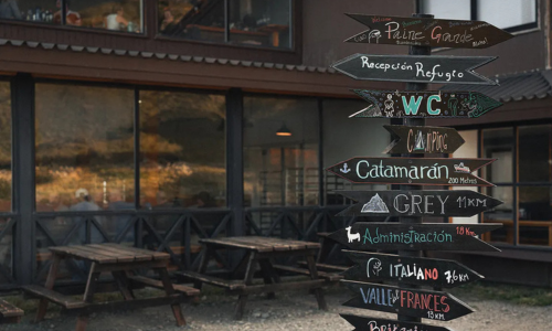
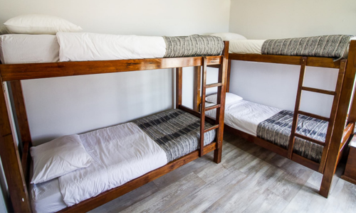
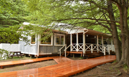
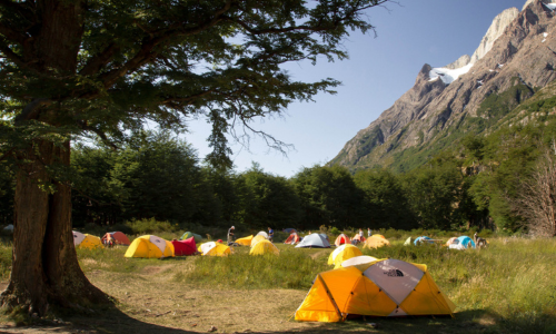
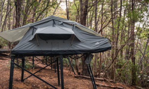
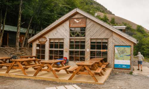
W Trek Campsites & Refugios
Every night on the W Trek must be booked in advance — no wild camping allowed. Luckily, the trail is lined with a well-managed mix of refugios and designated campsites.
Two companies manage all accommodation along the trail:
- Vertice Patagonia: Grey, Paine Grande
- Las Torres Patagonia: Chileno, Torres Central & Norte, Francés, Cuernos
Below is a list of all available accommodation options, including opening dates, facilities, and booking options to help you plan each night of your trek.
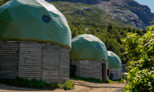
Camping & Refugio Grey (Vertice Patagonia) - opens on October 1st
- Check in 1 PM/Check out 9:30 AM
- Shared bathrooms, hot water showers, food service, designated cooking area, restaurant, bar, mini market
- Possible to rent sleeping bags, sleeping mats, tents
- Device charging possible during daytime hours
- Wi-Fi available for an extra fee
Camping & Refugio Paine Grande (Vertice Patagonia) - opens on October 1st
- Check in 1 PM/Check out 9:30 AM
- Shared bathrooms, hot water showers, food service, designated cooking area, restaurant, bar, mini market, cafeteria
- Possible to rent sleeping bags, sleeping mats and tents
- Device charging possible during daytime hours
- Wi-Fi available for an extra fee
Camping & Refugio Francés (Las Torres Patagonia) - opens on September 15th
- Shared bathrooms, hot water showers, designated cooking area, restaurant, food service, bar, mini market
- Possible to book a tent with or without sleeping bag or just a camping spot
- Fully made beds at the refugio
- Device charging possible during daytime hours
Camping & Refugio Cuernos (Las Torres Patagonia) - opens on November 1st
- Shared bathrooms, hot water showers, designated cooking area, restaurant, food service, bar, mini market
- Possible to book a tent with or without sleeping bag or just a camping spot
- Fully made beds at the refugio
- Device charging possible during daytime hours
Cuernos Mountain Cabins (Las Torres Patagonia) - opens on November 1st
- Private cabins (maximum capacity 2 people), fully made beds, towels, shared bathrooms, hot water showers, firewood heaters
- Designated cooking area, restaurant, food service, bar, mini market
- Device charging possible during daytime hours
Chileno Camping (Las Torres Patagonia) - opens on October 1st
- Campsite-only
- Shared bathrooms, hot water showers, food service, restaurant, bar, mini market
- Possible to book a tent with or without sleeping bag or just a camping spot
- Due to the high risk of forest fires, the use of stoves in the Chilean Sector is prohibited.
- Device charging possible during daytime hours
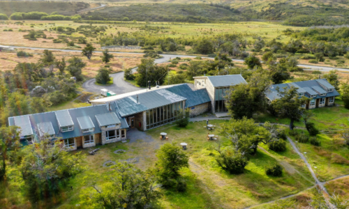
Camping & Refugio Central (Las Torres Patagonia) - Camping opens on September 15th, Refugio opens on October 1st
- Shared bathrooms, hot water showers, designated cooking area, restaurant, bar, mini market, food service
- Possible to book a tent with or without sleeping bag or just a camping spot
- Fully made beds at the refugio
- Device charging possible during daytime hours
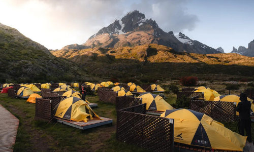
Campsites and Refugios along the W Trek
How difficult is the W Trek
The W Trek isn’t technical, but it’s no walk in the park either. Most days cover 15 to 20 km, with rolling terrain, rocky sections, and some decent elevation, especially on the day you hike to Base Torres.
You won’t need climbing gear or a guide (unless you’re hiking in winter), but you should be prepared for long days on your feet, unpredictable weather, and the kind of wind that makes you lean sideways.
The trail is well-marked and maintained, so if you’re in decent shape and used to walking for a few hours at a time, you’ll be fine.
Looking for something longer or more remote? Check out our full guide to the O Trek. ⬇️
The points of interest along the W Trek
The W Trek isn’t just about getting from one end to the other. It’s about what you see along the way. Each valley offers its own kind of drama, from hanging glaciers to granite towers and windswept ridgelines. These are the spots that define the Torres del Paine hike and make every kilometer worth it.
Ascencio Valley
This is the approach to Base Torres and whether you’re starting or finishing here, it’s a climb you’ll remember. The trail snakes through lenga forests and climbs steeply into a high alpine basin surrounded by sheer cliffs.
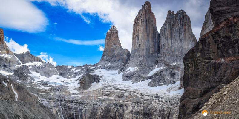
The Base Torres (Mirador las Torres)
The crown jewel. Three granite spires rise from a glacial lake. If you catch them at sunrise, the first light can turn the rock a glowing gold. It’s the image on every postcard, and yes, it lives up to the hype.
French Valley
One of the most dramatic stretches of the W Trek, the French Valley offers a 360-degree view of peaks, cliffs, and waterfalls. Watch and listen. You might hear the French Glacier cracking above.
French Glacier
You'll hear this one before you see it. Massive ice chunks calve off the hanging glacier and thunder into the valley. It’s loud and unforgettable.
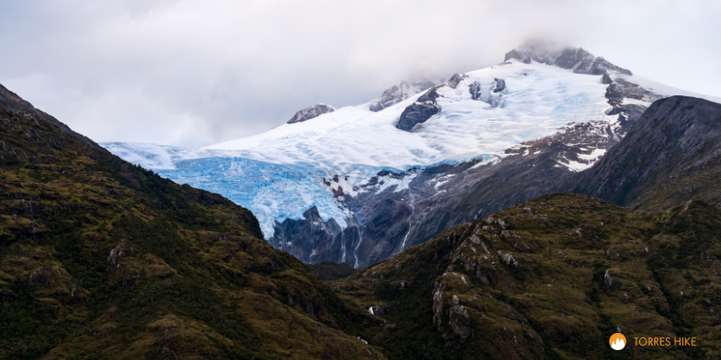
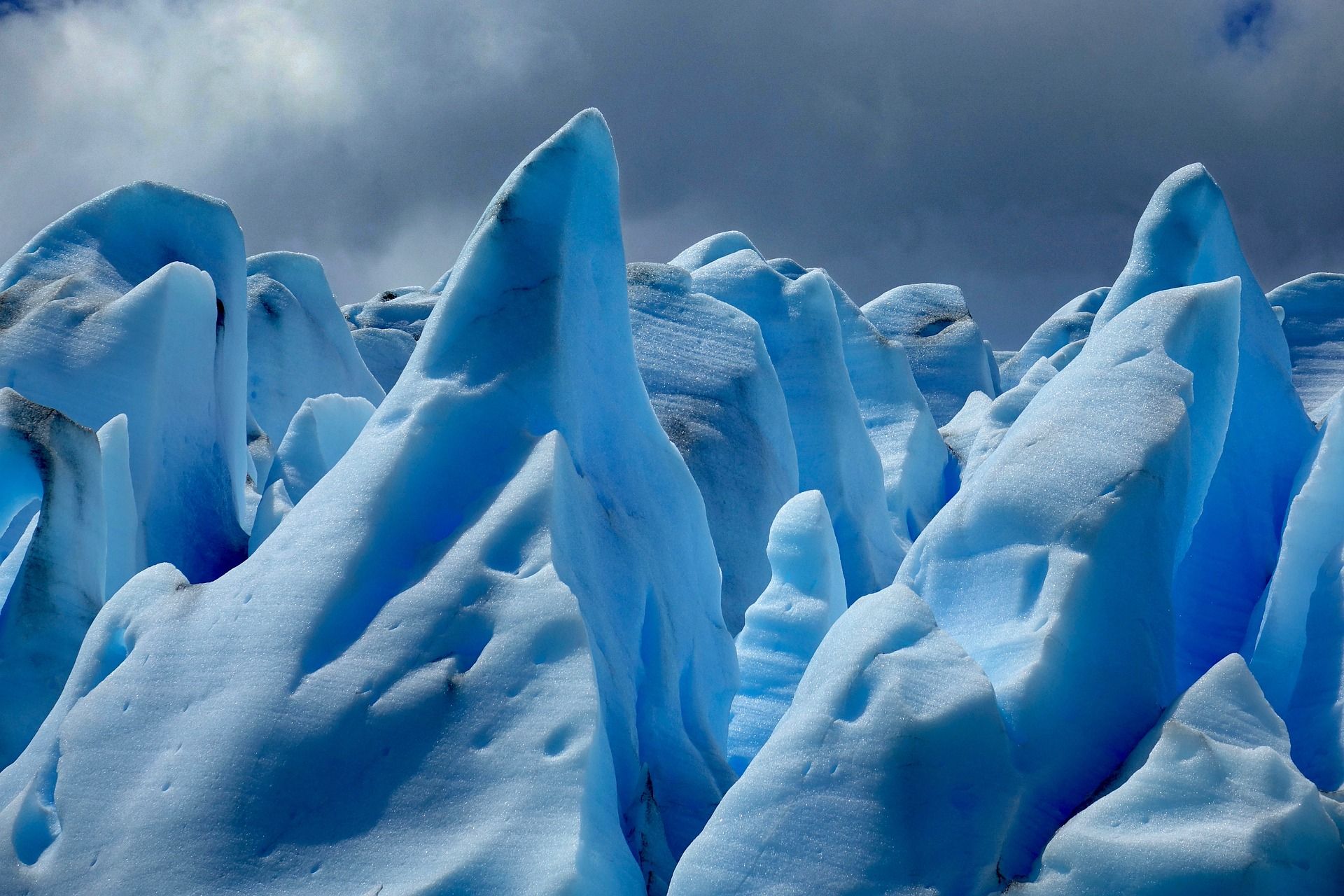
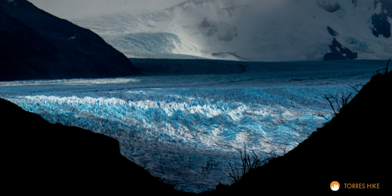
Grey Glacier
A vast wall of shifting blue ice marks the western edge of the W Trek. Grey Glacier is one of the park’s most visited sights — and for good reason. It’s part of the Southern Patagonian Ice Field, the largest ice mass in the Southern Hemisphere outside of Antarctica.
The glacier stretches about 6 kilometers wide and rises up to 30 meters high at its face. You can admire it from several viewpoints, but the most popular one is just a short walk from Refugio Grey.
If you have extra time (or energy), consider kayaking near the glacier or taking a boat tour across Lago Grey for a closer and unforgettable perspective.
When is the best time to go
The best time to hike the W Trek is during the Chilean summer, from December to February. This is peak season: the weather is milder, the days are long, and all campsites, refugios, and restaurants are open. The park is lively and the trails are busy, so it's essential to book your accommodation in advance.
If you prefer fewer people on the trail but still want access to most facilities, plan your trek for October, March, or early April. Prices may be slightly lower, availability is better, and the park is noticeably quieter.
November to early December marks the Patagonian spring. Nature is waking up, wildflowers begin to bloom, and the park is less crowded. However, the weather can be unpredictable, so come prepared for wind, rain, and sudden changes.
Mid-December to February is the peak season. Expect the most stable weather and the highest number of visitors. This is also when everything in the park is fully open.
April brings beautiful autumn colors and noticeably quieter trails. The weather cools quickly, the days are shorter, and trail conditions can shift without much warning.
What to pack for the W Trek
Packing for the W Trek takes a bit of planning. Patagonia’s weather is famously unpredictable. You might get sunshine, strong wind, rain, and even snow in the same day.
What you’ll need depends on how you plan to hike. If you’re staying in refugios with meals and bedding, you can keep your pack fairly light. But if you’re camping and cooking for yourself, you’ll need to bring more gear.
To make things easier, we’ve created a printable checklist you can use while getting ready.
When it comes to clothing, layering is key. You’ll want a flexible system that keeps you warm, dry, and comfortable — without overpacking. And trust us: the lighter your backpack, the better your knees will feel by day four.
With the right planning, the W Trek is an unforgettable adventure. Whether you’re heading out solo or with friends, camping or staying in refugios, we’re here to make the process smoother.
Browse available dates, compare campsites, and book your full W Trek itinerary in one place — no juggling multiple websites